| Description |
|---|
| Material: | Not Provided |
| Classification: | Not Provided |
| Field Name: | KK820316-4 STA54 RD32 |
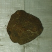
| Description: | ~ 200 kg. Cobble to boulder size fragments of submarine flows and pillows. Most (80%) are slightly phyric basalts containing plagioclase (2-10%) and olivine (1-3%) in fine grained to glassy ground masses. A majority have 2 mm - 5 mm glass rims with some phenocrysts and those grade inward into more crystalline matrix. Phenocryst proportions do not change inward. Nearly all are vesicular with the degree of vesicularity variable within each sample - average vesiclarity ~30%; pipe vesicles (cm-size) are common near surface of flows. Range of vesicularity from 5 - 60%. Sedimentary samples include a siltstone with fragments of glass, plag and ol; siltstone enclosing a large glassy basalt fragment; and bioturbated sandy siltstone with plag and ol fragments. A few % forams are present in these. HIG - 1 bag with described samples, 1 with 3 large samples, 2 others of undescribed rocks. SolIs - 1 bag with described samples, 1 (or 2) bags with undescribed rocks. |
| Age (min): | Not Provided |
| Age (max): | Not Provided |
| Collection Method: | Dredge |
| Collection Method Description: | Not Provided |
| Size: | Not Provided |
| Geological Age: | Not Provided |
| Geological Unit: | Not Provided |
| Comment: | Nine buckets of samples available- each individually labeled 1,1,2,3,3,4,4,5, and 9. |
| Purpose: | Geological studies |
| Geolocation |
|---|
| Latitude Start (WGS84): | -8.7846667 |
| Latitude End: | Not Provided |
| Longitude Start (WGS84): | 156.72133 |
| Longitude End: | Not Provided |
| Northing (m) (UTM NAD83): | Not Provided |
| Easting (m) (UTM NAD83): | Not Provided |
| Zone: | Not Provided |
| Vertical Datum: | Not Provided |
| Elevation Start: | Not Provided |
| Elevation End: | Not Provided |
| Nav Type: | Not Provided |
| Physiographic Feature: | Not Provided |
| Name Of Physiographic Feature: | Not Provided |
| Location Description: | Woodlark Basin near new Georgia. Depth start (m) 3,630. |
| Locality: | Not Provided |
| Locality Description: | Not Provided |
| Country: | Not Provided |
| State/Province: | Not Provided |
| County: | Not Provided |
| City: | Not Provided |
| Collection |
|---|
| Field Program/Cruise: | KK820316-4 |
| Platform Type: | Not Provided |
| Platform Name: | Not Provided |
| Platform Description: | Not Provided |
| Launch Type: | Not Provided |
| Launch Platform Name: | Not Provided |
| Launch ID: | Not Provided |
| Collector/Chief Scientist: | Not Provided |
| Collector/Chief Scientist Detail: | Not Provided |
| Collection Start Date: | 1982-06-01T04:00:00Z |
| Collection End Date: | Not Provided |
| Curation |
|---|
| Current Archive: | Not Provided |
| Current Archive Contact Details: | Not Provided |
| Original Archive: | Not Provided |
| Original Archive Contact Details: | Not Provided |
| Related Samples |
|---|
Parents: | No Parents | | Siblings: | No Siblings |
| Children: | No Children |
| Relevant Documents: |
|---|
|


 STA54 RD32.JPG (primary image)


